Business breakfast on Global Goals
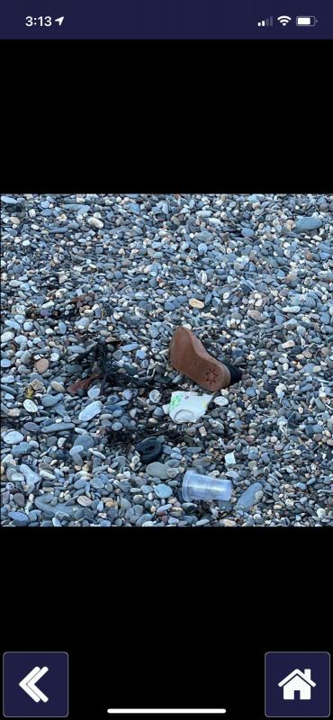
A critical part of protecting UNESCO Biospheres is monitoring and measuring issues of environmental concern. Increasingly, no matter where you are, one of these issues is pollution management. For the Isle of Man Biosphere this pollution too often takes the form of debris washing up on our beaches.
Monitoring what this pollution is made of and where it can be found – so it can be removed - is now an increasingly important part of managing our precious environment. No doubt many biospheres around the world face the same challenge.
In early 2020, members of the Isle of Man maritime community became involved in the Eyesea project and started to test an app which allowed seafarers, recreational sailors, and community volunteers to map observational reports of pollution. The app, launched publicly this month, is free to download and allows the user to take photographs of pollution and hazards at sea and on land.
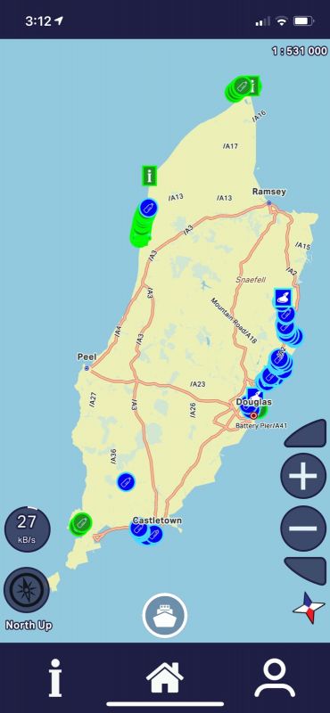
The data collected is integrated into maritime charts and maps and will be used to support ocean, harbour, coastal clean-ups, and scientific research.
Eyesea’s goal is to use this crowd-sourced environmental and navigational hazard data, to work with communities on behavioural change and clean up actions.
In an Isle of Man proof-of-concept project, Eyesea was used to map an area before a clean-up to increase the efficiency and effectiveness of a community beach clean-up event.
What the testing of the Eyesea app on the Isle of Man shows is that action is required to maintain the privilege of achieving and being awarded the UNESCO Biosphere status. It takes work, vigilance and a community that cares.
Eyesea founder, Graeme Somerville-Ryan, praised the support Eyesea had received globally from the shipping community, seafarers, and community volunteers in Canada, New Zealand, Norway, Chile, Australia, South Africa, India, Singapore and the Isle of Man, among others.
Graeme explained: ‘The feedback Eyesea has had from both those serving at sea and coastal clean-up warriors has been critical as a proof of concept. The Eyesea map shows and highlights the problems and the threat to a Biosphere.
‘The support we have had for our initiative has been truly humbling, demonstrating just how much people want to try and help solve the maritime pollution problem. Across the board we have been told the app is needed right now.'
Isle of Man resident and Chief Operating Officer of Eyesea, Catherine Robertshaw, said: ‘Access to up-to-date and accurate real-time pollution data greatly increases the options when it comes to cleaning up and allocating resources, which helps organisations plan their next clean up location and to drive action.
‘This sort of data just gives us so many more options when it comes to tangible action, and showing the impact of pollution on a local community.
‘On the Isle of Man we are so proud of, and want to protect, our unique UNESCO Biosphere, and the app gives us all the opportunity to play a role in collecting data to keep our Island clean.
‘By using the app and simply taking photos we can highlight issues and problem areas and ensure these sites are regularly cleaned by fantastic organisations like Beach Buddies and PlasticBusters.’
Posted up on 12th September 2021


